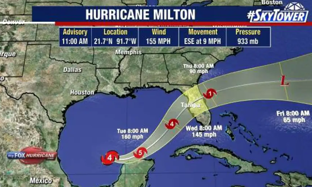
Hurricane Milton rapidly strengthened into a Category 5 storm Monday as the storm is projected to threaten areas of the Florida Peninsula still recovering from Hurricane Helene.
Milton quickly intensified Monday morning, growing from a Category 3 hurricane with maximum sustained winds estimated near 120 mph early in the day to a Category 5 storm with sustained winds near 160 mph by midday.
Later into the afternoon, the National Hurricane Center announced that the storm had reached sustained winds of 175 mph.
“MILTON EXPLOSIVELY INTENSIFIED WITH 175-MPH WINDS……RESIDENTS IN FLORIDA ARE URGED TO FOLLOW THE ADVICE OF LOCAL OFFICIALS,” the center said in a post on X.
The storm is forecast to weaken before hitting the Florida coast later this week, but it’s still projected to be a “large and powerful” hurricane once it makes landfall, the National Hurricane Center said midday Monday.
The hurricane center said an eastward to east-southeastward motion is expected through Monday night, followed by a turn toward the east and northeast on Tuesday and Wednesday. Milton is forecast to move near or just north of the Yucatan Peninsula Monday and Tuesday, then cross the eastern Gulf of Mexico and approach the west coast of the Florida Peninsula by Wednesday, the NHC said.
Rainfall amounts of 5 to 10 inches, with localized totals up to 15 inches, are expected across portions of the Florida Peninsula and the Keys through Wednesday night, the NHC said.
On Sunday, Florida Gov. Ron DeSantis expanded a state of emergency to 16 more counties, meaning 51 of Florida’s 67 counties are now part of the directive. A major hurricane is the most likely outcome,” DeSantis said. “This is not a good track for the state of Florida.”